This case study documents ARCO Worldwide’s deployment of the DJI Matrice 400RTK on a live high-voltage transmission line inspection. The corridor spanned 14 kilometres of varied terrain. It covers mission configuration, sensor findings, data outputs, and the operational conclusions drawn, presented for organisations considering a comparable deployment.
The Challenge: Why This Inspection Demanded a Different Approach
High-voltage transmission line corridors are among the most demanding environments in infrastructure inspection. The reasons are well documented. Corridors cover extended linear distances. Terrain is often inaccessible by road or foot. Conductors are energised. And critically, the defect types that matter most — thermal anomalies, mechanical wear, and vegetation encroachment — are simply not detectable by conventional ground-level visual inspection.
ARCO Worldwide approaches every deployment at the intersection of three disciplines: regulatory compliance, advanced aerial platforms, and actionable data intelligence. For this project, our objective was specific. We set out to determine whether the DJI Matrice 400RTK, equipped with a multi-sensor payload stack, could complete a full 14-kilometre corridor inspection within a single operational day. Moreover, we required that the data quality be sufficient to support informed maintenance prioritisation.
The Environment We Experienced
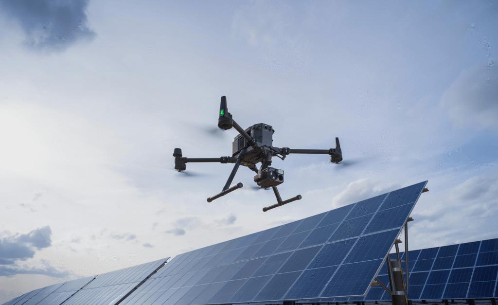
The corridor for this project was deliberately challenging. It consisted of open savanna, dense riparian vegetation, two river crossings, and a substation approach zone. This terrain is representative of the conditions our clients in power utilities, oil and gas, and infrastructure sectors routinely face. In short, it was an unforgiving test environment and that was precisely the point.
Mission Configuration: Building the Right Platform for the Task
Before deployment, ARCO Worldwide’s technical team configured the M400‘s payload based on the specific inspection objectives for this corridor. The platform supports up to seven simultaneously mounted devices with a combined payload capacity of 6 kg. That is a material advantage over preceding enterprise platforms, which required separate sorties for different sensor types.
The Payload Stack
For this mission, three core payloads were selected and configured together on a single airframe.
The Zenmuse H30T provided wide-angle imaging, 400x zoom, thermal infrared, a laser rangefinder, and NIR light — serving as the primary inspection tool for visual and thermal defect detection.
The Zenmuse L2 LiDAR combined frame-based LiDAR with a high-accuracy IMU and 4/3 CMOS RGB camera, handling corridor mapping and 3D structural point cloud acquisition.
The Manifold 3, a 100 TOPS onboard AI compute unit, performed real-time anomaly classification during flight — eliminating the need for post-flight processing delays.
Route Planning and Pre-Flight
Route planning was conducted in DJI FlightHub 2, using the platform’s slope and geometric route planning modes. As a result, the corridor was divided into three automated flight segments. The substation approach zone, however, required a different approach. Given its proximity to live infrastructure and the density of conductor arrays, that section was designated for supervised manual flight.
Pre-flight checks — including sensor calibration and battery verification — were completed at the launch point before the first operation commenced.
In the Field: What the Platform Delivered
The M400 departed with a total payload mass of approximately 4.2 kg. It transitioned smoothly into autonomous flight, with the rotating LiDAR and mmWave radar obstacle sensing system active from lift-off, continuously scanning the corridor ahead.
The First Significant Finding:Within 340 Metres
The platform’s obstacle sensing delivered an immediate result. Within the opening 340 metres of the first flight segment, the M400 detected a strand of informal fencing wire less than 22 mm in diameter. Crucially, this hazard did not appear on any existing survey map of the corridor. The aircraft halted autonomously. The pilot then manually avoided the obstacle and continued the mission.
This single detection event was among the most instructive outcomes of the entire deployment. It demonstrates clearly the operational gap between legacy survey methods and intelligent aerial inspection.
The M400 detected a fencing wire less than 22 mm in diameter that did not appear on any survey map. The aircraft halted autonomously. This was not a near-miss, it was the system performing exactly as designed.
Sortie Performance and Coverage
Each sortie sustained approximately 47 minutes of productive flight time at an operational altitude of 300 metres, within the manufacturer-rated ceiling with the H30T payload onboard. Three full sortie cycles were completed across the day, with in-field battery exchanges between each. Total productive airtime was just under 2.5 hours. That was sufficient to cover the entire 14-kilometre corridor without returning to a base vehicle.
The Conventional Alternative
To put this in context: an equivalent inspection using conventional methods would require manned helicopter overflights combined with ground-based walking survey teams. That approach spans four field days. Furthermore, the data it produces is of materially lower resolution. ARCO Worldwide’s single-day M400 deployment covered the same distance with superior sensor output across every category measured.
The Data: Findings That Drive Decisions
The value of a multi-sensor aerial platform lies in the quality and breadth of the data it returns. Across the 14-kilometre corridor, the combined payload stack produced four categories of findings.
Thermal Anomalies
The H30T infrared module identified three hotspots on conductor joints. These were indicative of early-stage resistance heating, anomalies that are invisible to conventional optical inspection and undetectable from the ground.
LiDAR Point Cloud
The Zenmuse L2 produced a high-density 3D point cloud of the full 14 km corridor. This enabled automated vegetation clearance analysis and precise conductor-to-obstruction proximity measurement.
Visual Defects
400x zoom imagery documented hardware corrosion, insulator string deformation, and two instances of damaged bird diverters across 23 transmission towers. Each defect was GPS-tagged for immediate maintenance action.
Vegetation Encroachment Zones
Seven sections were automatically flagged as clearance violations requiring immediate vegetation management intervention. The flagging occurred through real-time terrain-following and consistent ground sampling. No manual review required.
Intelligence in the Field, Not in the Office
A development that significantly changed our post-mission workflow was the real-time anomaly classification performed by the Manifold 3 onboard AI unit during flight. Rather than returning to the office with an unprocessed data archive, our mission operator reviewed flagged priority defects on the RC Plus 2 controller before the aircraft completed its return-to-home sequence. In other words, triage was happening in the field. Not days later.
The inspection team concluded field operations with a structured, prioritised defect register, not a hard drive of raw footage awaiting days of post-processing.
Three Outcomes That Reframe How We Approach This Work
This deployment demonstrated what changes operationally when a team transitions from legacy inspection methods to an intelligent, multi-sensor aerial platform. Three outcomes stand out as particularly significant.
1. Efficiency Without Compromise
A corridor inspection that previously required four field days of manned personnel was completed in a single operational day. More importantly, data quality was superior across every measure. Higher-resolution imagery, denser point clouds, and thermal data that ground personnel could not have safely acquired were all captured within the same mission cycle. This is now the operational benchmark ARCO Worldwide sets for corridor inspection engagements.
2. A Genuine Safety Outcome
Every section of the corridor where the M400 operated autonomously was a section where personnel did not need to ascend transmission structures, traverse beneath energised conductors, or navigate hazardous terrain. Therefore, removing field personnel from proximity to live high-voltage infrastructure is not an operational convenience. It is a safety outcome of material consequence. ARCO Worldwide’s deployment model places safety architecture at the centre of every mission plan.
3. Intelligence, Not Just Data
The integration of Manifold 3 onboard AI with DJI FlightHub 2 meant the team left the field with a prioritised maintenance action list — not a raw data archive. As a result, the interval between data acquisition and maintenance decision-making was substantially reduced. The confidence behind those decisions was also materially higher. This is the difference between data collection and intelligence delivery — and it is the standard ARCO Worldwide applies to every enterprise deployment.
Platform Applications Beyond Power Transmission
This deployment focused on high-voltage transmission line inspection. However, the M400’s modular payload architecture means the same platform can be readily reconfigured for a range of additional enterprise applications. ARCO Worldwide operates across all of the following domains.
Search and Rescue: The H30T thermal payload, S1 Spotlight, and V1 Loudspeaker can be deployed simultaneously on a single airframe. This enables teams to locate, illuminate, and communicate with subjects from a sustained aerial hover without placing personnel at risk.
Public Safety: Smart Detection tracks vehicles and individuals across thermal and RGB channels simultaneously. Consequently, the platform supports crowd monitoring and rapid aerial incident assessment with a single deployment.
Large-Scale Surveying: The Zenmuse P1 full-frame sensor delivers survey-grade photogrammetry at scale, well-suited to complex structural surfaces and wide-area terrain mapping.
Infrastructure Inspection: Beyond power lines, the M400 applies equally to bridges, wind turbines, and offshore platforms. Its takeoff and landing capability extends operational reach to marine and remote assets inaccessible by conventional means.
Extended Range Operations: The M400‘s 15–40 km transmission range enables broad operational coverage. Its Airborne Relay capability whereby one M400 unit functions as a communications relay for a second aircraft supports credible beyond-visual-line-of-sight operations, subject to appropriate regulatory authorisations.
Our Conclusion
The DJI Matrice 400RTK enables a fundamentally different approach to inspection operations. For any organisation managing transmission infrastructure, pipeline corridors, or large-area survey requirements, the platform warrants serious consideration.
The question is not whether the technology is sufficient, our deployment confirms that it is. Rather, the question is how quickly an organisation can build the operational framework: certified pilots, regulatory compliance, and data workflows. ARCO Worldwide exists to answer that question.
Fourteen kilometres of high-voltage transmission corridor. Completed in a single day. With higher data quality than four days of conventional inspection could produce. That is the M400 in practice and ARCO Worldwide is the team that delivered it.
Engage ARCO Worldwide
ARCO Worldwide has published a companion explainer video covering the DJI Matrice 400‘s full hardware architecture, payload ecosystem, and mission planning capabilities. This blog post is the field-based companion to that resource documenting what the platform looks like when it meets real terrain, real defects, and real operational constraints.
If your organisation operates in power utilities, oil and gas, public safety, telecoms, construction, or any sector requiring sustained aerial access to critical infrastructure, we welcome the opportunity to discuss what an M400-based inspection workflow would look like for your context.