Off the coast of the Niger Delta, an offshore platform stands against the Atlantic swell. It is a steel city of pipes, valves, and flare stacks, and it pumps the lifeblood of the Nigerian economy. For decades, keeping a structure like this safe was slow and dangerous work. Technicians scaled its steel frame on ropes. Production stopped for days. And teams could only hope to catch a defect before it caused real damage. Today, offshore drone inspection has changed that picture completely. A drone lifts from the helideck, climbs in a slow arc, and within hours captures everything those crews once risked their lives to find, along with a great deal they could never reach at all.
This is not a forecast of the future. It is the working reality for Nigeria’s most progressive operators. And it signals a fundamental shift in how the nation inspects its critical assets and secures its territorial waters.
Why Offshore Drone Inspection Replaces the Old Way
Offshore oil and gas infrastructure ranks among the most valuable equipment on earth. It is also among the most punished. Salt-laden air drives corrosion. Mechanical and thermal stress cause fatigue. And because these installations sit far out at sea, every inspection becomes a major undertaking.
The old approach was slow, costly, and dangerous. It relied on rope-access technicians suspended from flare booms. It burned through helicopter fuel and budget. And it forced production shutdowns that cost operators dearly for every idle hour. Offshore drone inspection makes that entire model obsolete.
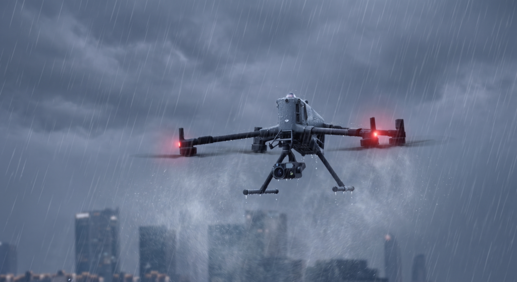
A single drone, fitted with optical, thermal, and gas-detection payloads, can survey a platform from waterline to flare tip. It does not interrupt operations. It does not put personnel at risk. A task that once demanded a multi-day crew effort now takes one pilot a single shift. Flare stacks can be examined while live. Engineers map risers and subsea connection points precisely. And corrosion, hairline cracks, and heat anomalies invisible to the eye show up in fine detail. Multi-sensor payloads such as the DJI Zenmuse H30T combine high-magnification zoom with radiometric thermal imaging, so inspectors capture this detail from a safe distance, without ever approaching a live hazard.
The economic case is immediate. You see it in downtime averted, helicopter hours eliminated, and inspections finished in hours rather than weeks. Yet the deeper advantage is not speed but sight. A drone sees what a technician on a rope simply cannot reach.
From Observation to Intelligence
A camera in the sky is useful. An intelligent eye is transformative.
When AI-driven anomaly detection processes a drone’s imagery, inspection stops being a single snapshot. Instead, it becomes a story told over time. Each flight builds on the last. The system tracks a faint patch of corrosion from one survey to the next, measuring it as it develops. As a result, it flags structural fatigue long before that fatigue leads to failure.
The consequence is a clear shift from reactive to predictive maintenance. Offshore drone inspection turns upkeep from guesswork into foresight. Operators no longer wait for sudden breakdowns. Instead, they schedule repairs on their own terms, guided by data rather than emergency. This is the difference between merely inspecting an asset and truly protecting one. It is a difference that matters enormously, because a single undetected fault can trigger catastrophic spillage, lost production, and lasting environmental harm.
Securing Nigeria’s Waterways from the Air
Here lies the elegant logic behind aerial intelligence. The very drone that inspects an installation also guards the waters around it.
Nigeria’s maritime domain is under constant pressure. Crude oil theft and illegal bunkering drain billions from the economy each year, and they inflict severe damage on the Delta’s fragile ecosystems. Meanwhile, pirates and unauthorised vessels exploit the vast expanse of the Gulf of Guinea, where the sea is simply too wide for surface patrols to watch alone.
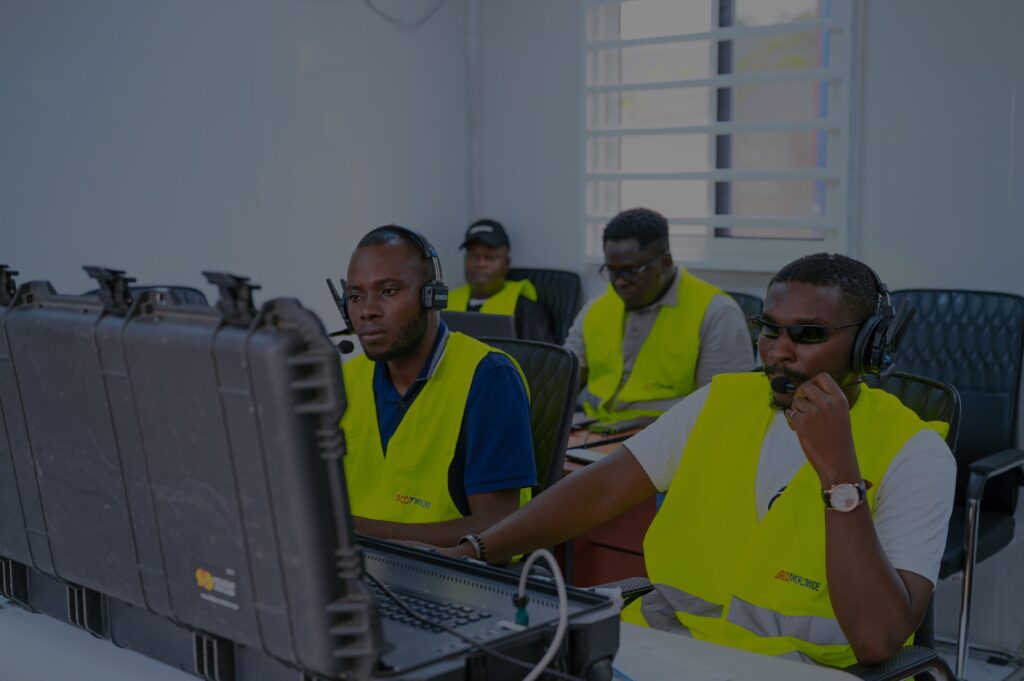
Aerial intelligence narrows that gap. The same systems used for offshore drone inspection can sweep open water for threats. They identify illicit tapping points, track suspect vessels, and recognise the clear signatures of bunkering across water and wetland. Through Beyond Visual Line of Sight (BVLOS) operations, a single drone patrols for hours, covering ground that would otherwise need a fleet of vessels or a manned aircraft at many times the cost. Intelligence then flows to onshore teams in real time. Operators detect a perimeter breach the instant it happens, and they map a spill within minutes, so containment can begin before the damage spreads.
Crucially, however, drones do not work in isolation. Their value grows when they act as one layer within a coordinated defence. Aerial surveillance integrates with vessel-tracking systems, surface patrols, and onshore command centres to build a single, living picture of the maritime domain. Scattered data points then coalesce into shared awareness, so decision-makers act faster, with better information, and across a far wider area than any single tool could cover. The future of maritime security is not a contest between new technology and established practice. Rather, it is the deliberate convergence of the two.
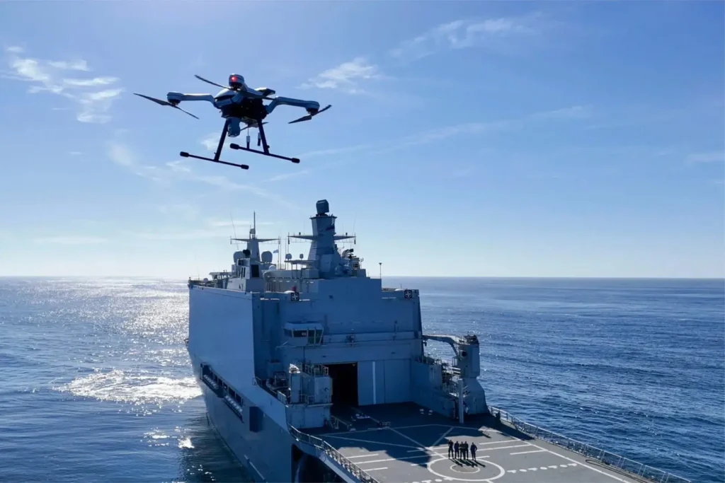
This is exactly the path Nigeria has charted. This June, the Nigerian Navy hosted the 6th Sea Power for Africa Symposium in Lagos as part of its 70th anniversary. The theme was clear: leveraging technology for enhanced maritime security across the continent. ARCO Worldwide was proud to exhibit, joining a hub where naval leadership set out a bold ambition: to build a highly digitised, networked force ready for emerging threats. Persistent awareness from the air is among the most cost-effective ways to deliver exactly that.
A Sovereign Drone Capability for Nigeria
For too long, advanced aerial intelligence has arrived in Nigeria like a visitor. It flies in for a single project, then flies out when the engagement ends. The threats facing the nation’s waters, however, are neither occasional nor temporary. They are persistent. So the capability to meet them should be equally enduring: resident, accountable, and Nigerian.
This is the principle behind ARCO Worldwide. The company delivers surveillance, inspection, and geospatial intelligence across multiple sectors, and across the entire oil and gas value chain, both onshore and offshore, above the surface and below it. In doing so, it gives operators and security stakeholders the aerial infrastructure to monitor, protect, and optimise their most valuable assets. From platform monitoring and leak detection to bunkering surveillance, perimeter protection, emergency spill response, and regulation-grade inspection reporting, the capability spans both the commercial and the strategic within a single, integrated service.
For survey-grade mapping and 3D modelling, a dedicated photogrammetry payload such as the DJI Zenmuse P1 delivers the centimetre-accurate baseline data against which teams can later measure structural change. Together, these tools make offshore drone inspection not just a service, but a complete intelligence capability.
Drone technology has travelled a remarkable arc, from novelty to instrument to necessity. It inspects a flare stack at dawn and helps guard a coastline by dusk. For a nation whose prosperity and security rise and fall with its waters, that dual power is not a convenience. It is a strategic advantage waiting to be claimed.
The question is no longer whether aerial intelligence belongs in Nigeria’s maritime domain. It is how quickly the nation deploys it, and whom it trusts to fly it.
Interested in offshore drone inspection and security solutions for your operations? Get in touch with ARCO Worldwide.