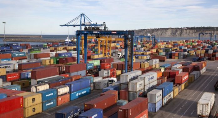
Port Surveillance by Drone: See the Whole Yard at Once
From the gatehouse, a terminal is a wall of containers. From a crane cab, it is a narrow corridor. Nobody at ground level sees the whole operation at the same moment.
That limitation shapes everything from security to yard planning. Port surveillance from the air removes it.
Four problems that share one cause
Terminals face several distinct pressures, and most trace back to incomplete visibility.
Security. Perimeters are long, and stacked containers create blind corners that fixed cameras cannot cover.
Yard management. Congestion builds gradually, and by the time it registers on the ground, it has already slowed operations.
Asset condition. Quay walls, cranes, fenders and conveyor structures sit in a corrosive environment, yet inspection access is difficult and often requires downtime.
Bulk measurement. Stockpiles of aggregate, grain or coal get estimated rather than measured, which affects reconciliation.
What aerial coverage changes
A drone sees the terminal as one scene rather than a sequence of views.
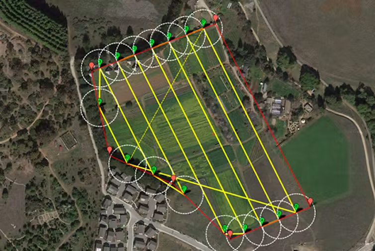
Within a single flight, you capture perimeter condition, yard occupancy, vessel and berth activity, and the state of fixed infrastructure. Because the route repeats, comparisons become possible across days or weeks.
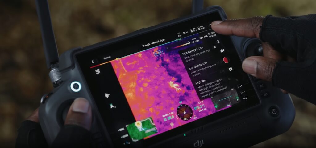
In addition, thermal imaging extends coverage into the night, when most perimeter incidents occur and when visual cameras lose their advantage.
Best-fit DJI platform: Matrice 4T
For general terminal work, the strongest fit in the DJI Enterprise range is the Matrice 4T.
It carries wide, medium tele and long-range tele cameras alongside a thermal sensor. That mix suits the variety a port demands. The tele cameras read container markings and inspect crane structures from a distance, while thermal covers perimeter and night operations.
Deployment speed matters here too, since a terminal cannot pause for a survey crew.
Structural inspection and continuous coverage
Detailed asset work needs more capability. The Matrice 350 RTK with the Zenmuse H30T inspects quay walls, crane booms, fenders and conveyor structures, with zoom and laser ranging that keep the aircraft clear of moving equipment.
For mapping and bulk volumes, Zenmuse P1 delivers survey-grade photogrammetry across the yard.
Where coverage needs to be continuous, DJI Dock 3 with the Matrice 4TD flies automated perimeter and yard routes on a schedule, day and night, with nobody travelling to site.
What terminal operators receive
Under our Drone as a Service model, ARCO Worldwide delivers:
- Perimeter surveillance with thermal night coverage
- Yard occupancy mapping and congestion analysis
- Orthomosaic maps of the full terminal footprint
- Structural condition reports for cranes, quays and fenders
- Volumetric measurement of bulk stockpiles
- Change-detection reporting between flights
- Incident documentation with timestamped imagery
Your operations and security teams receive a current picture. We manage the aviation.
Airspace coordination comes first
Ports frequently sit close to controlled airspace, and some adjoin airports directly.
That makes authorisation and coordination a precondition rather than a formality. Any operator unable to demonstrate both should not be flying over a terminal.
ARCO Worldwide is Nigeria’s first licensed commercial drone operator, authorised by the NCAA for nationwide commercial operations and approved by the Office of the National Security Adviser. Our operations run under ISO 9001:2015 certified processes.
As Nigeria’s only DJI Enterprise Authorized Reseller and Enterprise Solutions Partner, we match the platform to the requirement. With bases in Lagos, Abuja and Port Harcourt, we support terminals across the country’s main corridors.
Beyond the terminal gate
The same capability extends along the chain.
Road and rail corridors feeding a port benefit from infrastructure inspection and route monitoring. Cargo in transit gains route risk assessment, while bridges and access structures receive condition assessment without closing lanes.
One view, not twenty
A terminal runs on coordination, and coordination depends on everyone working from the same picture.
Aerial port surveillance provides that picture. It covers the whole footprint in one pass, records what it sees, and makes yesterday comparable to today.
Ready to see your terminal from above? Talk to ARCO Worldwide today.